
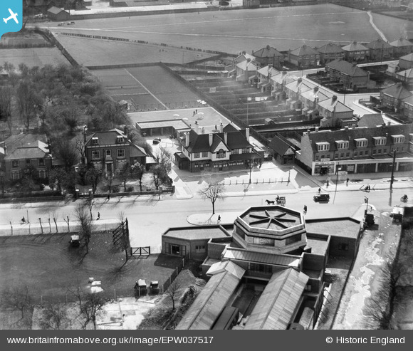
EPW037517 ENGLAND (1932). "The Earl Haigh" public house opposite Hounslow West Station, Hounslow, 1932
© Hawlfraint cyfranwyr OpenStreetMap a thrwyddedwyd gan yr OpenStreetMap Foundation. 2024. Trwyddedir y gartograffeg fel CC BY-SA.
Delweddau cyfagos (16)
EPW037517

EPW037334

EPW037519

EPW037518

EPW037296

EPW016528

EPW016529

EPW016527

EPW037332

EPW033774

EPW017168

EPW017162

EPW037294

EPW035079

EPW035093

EPW033773

Manylion
| Pennawd | [EPW037517] "The Earl Haigh" public house opposite Hounslow West Station, Hounslow, 1932 |
| Cyfeirnod | EPW037517 |
| Dyddiad | April-1932 |
| Dolen | |
| Enw lle | HOUNSLOW |
| Plwyf | |
| Ardal | |
| Gwlad | ENGLAND |
| Dwyreiniad / Gogleddiad | 512187, 176088 |
| Hydred / Lledred | -0.38455140264981, 51.472132926342 |
| Cyfeirnod Grid Cenedlaethol | TQ122761 |
Pinnau
Byddwch y cyntaf i ychwanegu sylw at y ddelwedd hon!
Cyfraniadau Grŵp
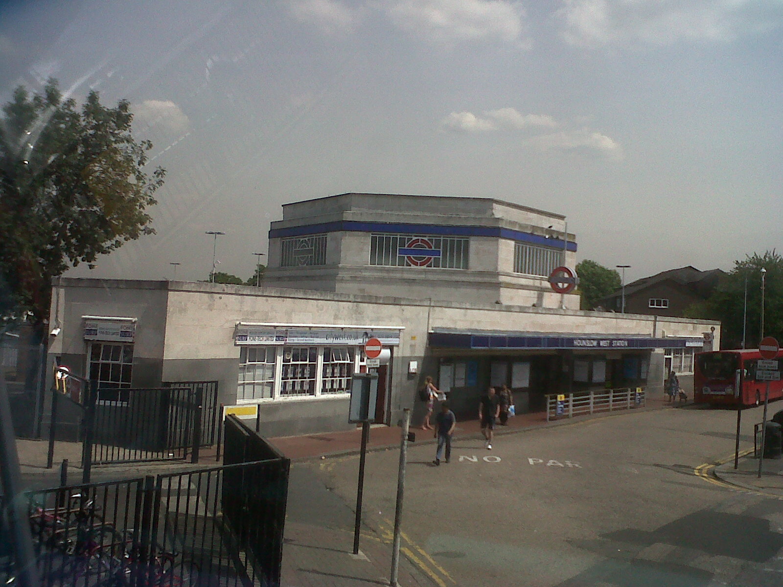 Hounslow West Underground Station. Photograph taken yesterday. |
 Class31 |
Wednesday 17th of July 2013 09:53:23 AM |
Fantastic! I'm hoping to make a trip up the Edgware Road and around Hendon to make some similar comparisons in north London. |
Katy Whitaker |
Wednesday 17th of July 2013 09:53:23 AM |


