
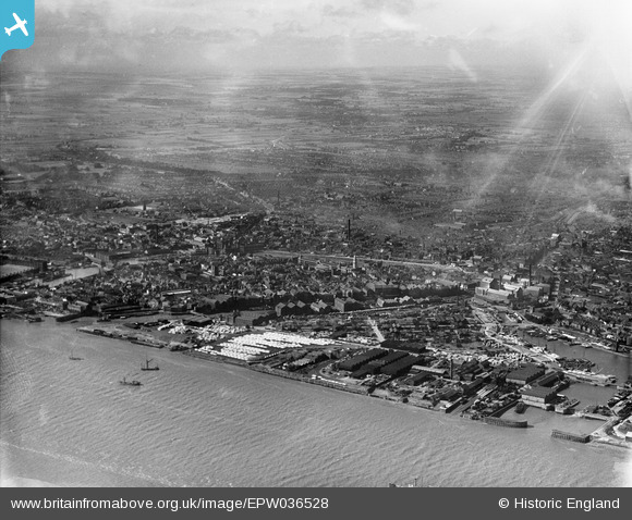
EPW036528 ENGLAND (1931). Garrison Side and the city, Kingston upon Hull, from the south-east, 1931
© Hawlfraint cyfranwyr OpenStreetMap a thrwyddedwyd gan yr OpenStreetMap Foundation. 2024. Trwyddedir y gartograffeg fel CC BY-SA.
Delweddau cyfagos (12)
EPW036528

EPW012702

EPW062615

EPW062613

EPW062614

EPW062611

EPW062612

EPW036426

EPW036561

EPW036437

EPW036502

EAW015659

Manylion
| Pennawd | [EPW036528] Garrison Side and the city, Kingston upon Hull, from the south-east, 1931 |
| Cyfeirnod | EPW036528 |
| Dyddiad | August-1931 |
| Dolen | |
| Enw lle | KINGSTON UPON HULL |
| Plwyf | |
| Ardal | |
| Gwlad | ENGLAND |
| Dwyreiniad / Gogleddiad | 510558, 428542 |
| Hydred / Lledred | -0.32350978749029, 53.741298272531 |
| Cyfeirnod Grid Cenedlaethol | TA106285 |


