
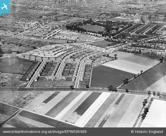
EPW036489 ENGLAND (1931). New housing at Ashburton Avenue and Meadway, Ilford, 1931
© Hawlfraint cyfranwyr OpenStreetMap a thrwyddedwyd gan yr OpenStreetMap Foundation. 2024. Trwyddedir y gartograffeg fel CC BY-SA.
Delweddau cyfagos (5)
EPW036489

EPW036491

EPW036490

EPW036493

EPW036492

Manylion
| Pennawd | [EPW036489] New housing at Ashburton Avenue and Meadway, Ilford, 1931 |
| Cyfeirnod | EPW036489 |
| Dyddiad | August-1931 |
| Dolen | |
| Enw lle | ILFORD |
| Plwyf | |
| Ardal | |
| Gwlad | ENGLAND |
| Dwyreiniad / Gogleddiad | 545490, 185556 |
| Hydred / Lledred | 0.098600306041133, 51.549633057309 |
| Cyfeirnod Grid Cenedlaethol | TQ455856 |
Pinnau
 Hermann the German |
Wednesday 16th of August 2017 05:57:18 PM | |
Hermann the German |
Wednesday 16th of August 2017 05:54:16 PM | |
Hermann the German |
Tuesday 15th of August 2017 02:40:20 PM | |
Hermann the German |
Monday 14th of August 2017 07:52:18 PM | |
Hermann the German |
Monday 14th of August 2017 07:51:37 PM | |
Hermann the German |
Monday 14th of August 2017 07:50:56 PM | |
Chelmerfella |
Monday 16th of December 2013 10:38:03 PM | |
Chelmerfella |
Monday 16th of December 2013 10:37:07 PM | |
Hermann the German |
Wednesday 16th of October 2013 12:22:48 PM | |
Hermann the German |
Wednesday 16th of October 2013 12:21:15 PM | |
Hermann the German |
Wednesday 16th of October 2013 12:19:57 PM | |
Hermann the German |
Wednesday 16th of October 2013 12:19:17 PM | |
Hermann the German |
Wednesday 16th of October 2013 12:14:29 PM |


