
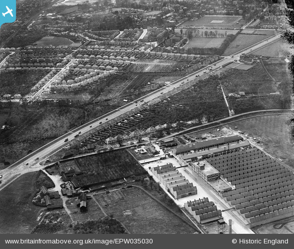
EPW035030 ENGLAND (1931). The Imperial Biscuit Works and the Great West Road, Osterley, 1931
© Hawlfraint cyfranwyr OpenStreetMap a thrwyddedwyd gan yr OpenStreetMap Foundation. 2024. Trwyddedir y gartograffeg fel CC BY-SA.
Delweddau cyfagos (20)
EPW035030

EPW035025

EPW035036

EPW035026

EPW035021

EPR000526

EPW035029

EPW035031

EPW040959

EPR000689

EPR000524
 Ltd Soldering Fluid Manufactory on the Great West Road, Spring Grove, 1935")
EPR000525
 Ltd Soldering Fluid Manufactory on the Great West Road, Spring Grove, 1935")
EPW032161

EPW034934

EPW027556

EPW040958

EPW034933

EPW040960

EPW034932

EPW051810

Manylion
| Pennawd | [EPW035030] The Imperial Biscuit Works and the Great West Road, Osterley, 1931 |
| Cyfeirnod | EPW035030 |
| Dyddiad | April-1931 |
| Dolen | |
| Enw lle | OSTERLEY |
| Plwyf | |
| Ardal | |
| Gwlad | ENGLAND |
| Dwyreiniad / Gogleddiad | 515992, 177379 |
| Hydred / Lledred | -0.32936152742297, 51.482969958314 |
| Cyfeirnod Grid Cenedlaethol | TQ160774 |


