
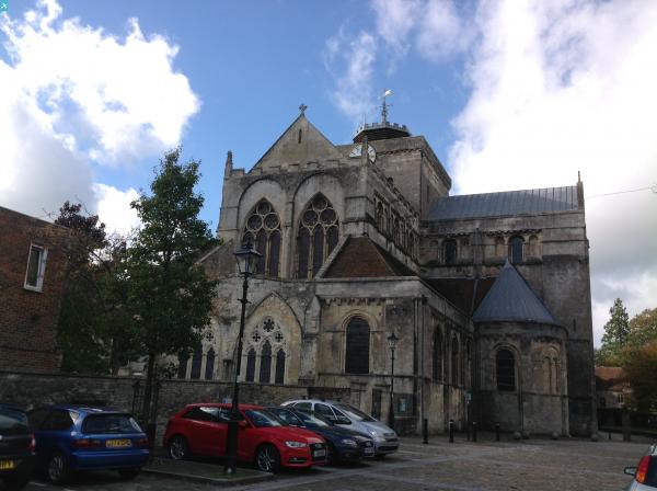
EPW032327 ENGLAND (1930). The Abbey Church of St Mary, Strong's Brewery and the town centre, Romsey, 1930

© Hawlfraint cyfranwyr OpenStreetMap a thrwyddedwyd gan yr OpenStreetMap Foundation. 2024. Trwyddedir y gartograffeg fel CC BY-SA.
Delweddau cyfagos (21)
EPW032327

EPW013635

EPW013640

EPW032325

EAW034102

EPW013638

EAW034103

EAW034105

EPW032328

EAW034106

EAW034099

EAW034100

EPW013641

EPW013636

EAW034101

EPW013639

EPW032326

EAW034098

EAW034097

EPW056976

EAW034104

Manylion
| Pennawd | [EPW032327] The Abbey Church of St Mary, Strong's Brewery and the town centre, Romsey, 1930 |
| Cyfeirnod | EPW032327 |
| Dyddiad | June-1930 |
| Dolen | |
| Enw lle | ROMSEY |
| Plwyf | ROMSEY |
| Ardal | |
| Gwlad | ENGLAND |
| Dwyreiniad / Gogleddiad | 435154, 121155 |
| Hydred / Lledred | -1.4990917202072, 50.988178802924 |
| Cyfeirnod Grid Cenedlaethol | SU352212 |
Pinnau


Cyfraniadau Grŵp
 The Abbey Church of St Mary, Strong's Brewery and the town centre, Romsey, 1930 |
 Christopher |
Sunday 27th of January 2013 11:53:20 AM |


