
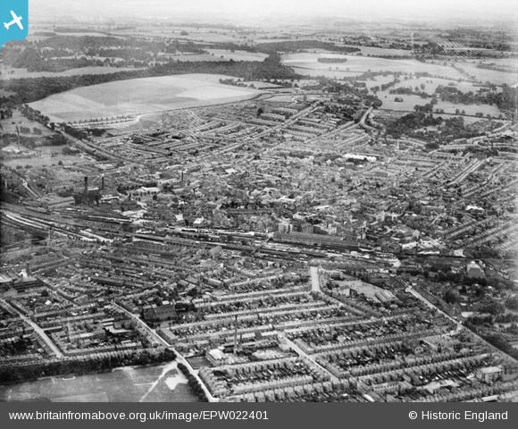
EPW022401 ENGLAND (1928). The town, Luton, from the north, 1928
© Hawlfraint cyfranwyr OpenStreetMap a thrwyddedwyd gan yr OpenStreetMap Foundation. 2024. Trwyddedir y gartograffeg fel CC BY-SA.
Delweddau cyfagos (15)
EPW022401

EPW034884

EPW034880

EPW034881

EPW035119

EPW035120

EPW035121

EPW034883

EPW035123

EPW035122

EPW034877

EPW034885

EPW034878

EPW034879

EPW034882

Manylion
| Pennawd | [EPW022401] The town, Luton, from the north, 1928 |
| Cyfeirnod | EPW022401 |
| Dyddiad | 9-August-1928 |
| Dolen | |
| Enw lle | LUTON |
| Plwyf | |
| Ardal | |
| Gwlad | ENGLAND |
| Dwyreiniad / Gogleddiad | 509297, 221881 |
| Hydred / Lledred | -0.41181135751418, 51.884323120896 |
| Cyfeirnod Grid Cenedlaethol | TL093219 |
Pinnau
 Farley Hill |
Tuesday 16th of April 2013 06:45:09 PM | |
 Dylan Moore |
Friday 26th of October 2012 09:54:09 PM | |
Dylan Moore |
Friday 26th of October 2012 09:53:26 PM | |
Dylan Moore |
Friday 26th of October 2012 09:52:31 PM | |
Dylan Moore |
Friday 26th of October 2012 09:51:47 PM | |
Dylan Moore |
Friday 26th of October 2012 09:50:58 PM | |
Dylan Moore |
Friday 26th of October 2012 09:49:16 PM |


