
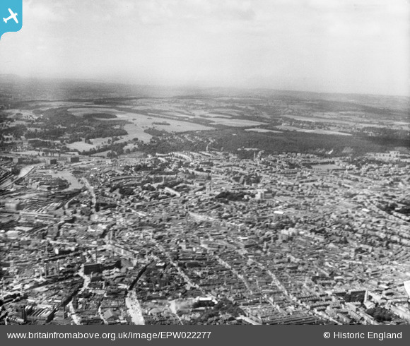
EPW022277 ENGLAND (1928). The city, Bristol, from the east, 1928
© Hawlfraint cyfranwyr OpenStreetMap a thrwyddedwyd gan yr OpenStreetMap Foundation. 2024. Trwyddedir y gartograffeg fel CC BY-SA.
Delweddau cyfagos (17)
EPW022277

EPW005431

EPW005432

EPW005429

EPW005430

EPW005428

EPW060118

EPW005419

EPW005427

EPW005423

EPW047090

EPW005426

EPW005425

EPW005424

EAW050555

EPW033500

EPW005422

Manylion
| Pennawd | [EPW022277] The city, Bristol, from the east, 1928 |
| Cyfeirnod | EPW022277 |
| Dyddiad | August-1928 |
| Dolen | |
| Enw lle | BRISTOL |
| Plwyf | |
| Ardal | |
| Gwlad | ENGLAND |
| Dwyreiniad / Gogleddiad | 358739, 173175 |
| Hydred / Lledred | -2.5939117889312, 51.455560904956 |
| Cyfeirnod Grid Cenedlaethol | ST587732 |
Pinnau
 Class31 |
Thursday 12th of December 2013 03:25:57 PM | |
Class31 |
Saturday 19th of January 2013 10:56:07 PM | |
 Isleworth1961 |
Friday 7th of September 2012 10:22:56 PM | |
Isleworth1961 |
Friday 7th of September 2012 10:21:41 PM | |
Isleworth1961 |
Friday 7th of September 2012 10:17:43 PM | |
Isleworth1961 |
Friday 7th of September 2012 10:16:50 PM | |
Class31 |
Wednesday 11th of July 2012 12:51:06 PM | |
Class31 |
Wednesday 11th of July 2012 12:44:38 PM |
Cyfraniadau Grŵp
its just great to see bristol before the war and its buildingskeep it up . |
royston radford |
Wednesday 24th of October 2012 08:21:52 AM |


