
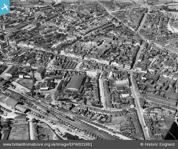
EPW021861 ENGLAND (1928). The Town Centre, West Bromwich, 1928
© Hawlfraint cyfranwyr OpenStreetMap a thrwyddedwyd gan yr OpenStreetMap Foundation. 2024. Trwyddedir y gartograffeg fel CC BY-SA.
Delweddau cyfagos (7)
EPW021861

EPW057563

EPW057562

EPW001118

EPW057564

EPW021862

EPW061254

Manylion
| Pennawd | [EPW021861] The Town Centre, West Bromwich, 1928 |
| Cyfeirnod | EPW021861 |
| Dyddiad | July-1928 |
| Dolen | |
| Enw lle | WEST BROMWICH |
| Plwyf | |
| Ardal | |
| Gwlad | ENGLAND |
| Dwyreiniad / Gogleddiad | 400661, 290993 |
| Hydred / Lledred | -1.9902580932286, 52.516455935885 |
| Cyfeirnod Grid Cenedlaethol | SP007910 |
Pinnau
 H |
Tuesday 7th of February 2023 05:39:51 PM | |
Rob |
Friday 26th of August 2022 03:03:46 PM | |
Gill |
Saturday 24th of October 2020 06:27:10 PM | |
scoop115 |
Monday 16th of April 2018 02:56:56 PM | |
 |
 Class31 |
Thursday 20th of August 2015 05:23:00 PM |
DaveT |
Saturday 18th of July 2015 12:58:23 PM | |
DaveT |
Sunday 20th of April 2014 09:10:47 AM | |
DaveT |
Sunday 20th of April 2014 09:07:17 AM | |
DaveT |
Sunday 20th of April 2014 09:05:22 AM | |
DaveT |
Sunday 20th of April 2014 08:57:21 AM | |
DaveT |
Saturday 19th of April 2014 09:32:30 PM | |
Lou789 |
Friday 13th of July 2012 10:56:02 PM |


