
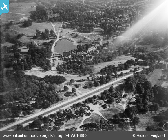
EPW016652 ENGLAND (1926). The Hampstead Pond and the Vale of Health, Hampstead Heath, 1926
© Hawlfraint cyfranwyr OpenStreetMap a thrwyddedwyd gan yr OpenStreetMap Foundation. 2024. Trwyddedir y gartograffeg fel CC BY-SA.
Delweddau cyfagos (15)
EPW016652

EPW056652

EPW000815

EAW000612

EPW009353

EPW000430

EPW026948

EPW013228

EPW005126

EPW028171

EPW000818

EPW005118

EPW028170

EPW056655

EPW026949

Manylion
| Pennawd | [EPW016652] The Hampstead Pond and the Vale of Health, Hampstead Heath, 1926 |
| Cyfeirnod | EPW016652 |
| Dyddiad | August-1926 |
| Dolen | |
| Enw lle | HAMPSTEAD HEATH |
| Plwyf | |
| Ardal | |
| Gwlad | ENGLAND |
| Dwyreiniad / Gogleddiad | 526474, 186525 |
| Hydred / Lledred | -0.17518381948491, 51.562926267652 |
| Cyfeirnod Grid Cenedlaethol | TQ265865 |


