
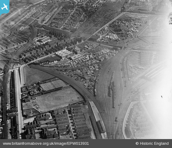
EPW013931 ENGLAND (1925). Timber Yards at Hedon Road and environs, Kingston upon Hull, 1925
© Hawlfraint cyfranwyr OpenStreetMap a thrwyddedwyd gan yr OpenStreetMap Foundation. 2024. Trwyddedir y gartograffeg fel CC BY-SA.
Delweddau cyfagos (29)
EPW013931

EPW042799

EPW042796

EPW042797

EAW018586

EPW055038

EPW013930

EPW013933

EPW013932

EPW013928

EAW018589

EPW042801

EPW013929

EAW018592

EAW018588

EPW042795

EPW042798

EPW042064

EPW042061

EPW042065

EAW018590

EPW055035

EAW018585

EPW042062

EPW055044

EPW042063

EAW018591

EAW018587

EPW062607

Manylion
| Pennawd | [EPW013931] Timber Yards at Hedon Road and environs, Kingston upon Hull, 1925 |
| Cyfeirnod | EPW013931 |
| Dyddiad | 25-July-1925 |
| Dolen | |
| Enw lle | KINGSTON UPON HULL |
| Plwyf | |
| Ardal | |
| Gwlad | ENGLAND |
| Dwyreiniad / Gogleddiad | 511387, 429422 |
| Hydred / Lledred | -0.31062768599464, 53.74902877737 |
| Cyfeirnod Grid Cenedlaethol | TA114294 |
Pinnau
 John Wass |
Thursday 12th of February 2015 04:34:08 PM | |
John Wass |
Tuesday 11th of November 2014 03:26:43 PM | |
CRB |
Saturday 19th of April 2014 05:22:36 PM | |
YingTang |
Friday 6th of July 2012 11:34:29 AM |


