
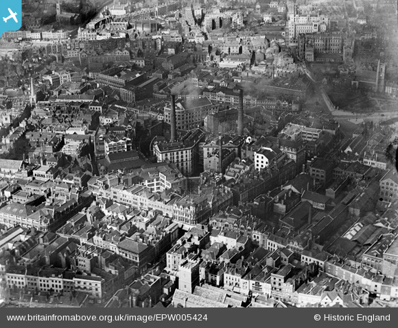
EPW005424 ENGLAND (1921). Fry's Cocoa Manufactory on Union Street and environs, Bristol, 1921
© Hawlfraint cyfranwyr OpenStreetMap a thrwyddedwyd gan yr OpenStreetMap Foundation. 2024. Trwyddedir y gartograffeg fel CC BY-SA.
Delweddau cyfagos (17)
EPW005424

EPW005425

EPW005426

EPW005421

EPW005423

EPW005427

EPW005420

EPW005422

EPW033500

EPW060118

EPW005419

EPW005428

EAW050553

EPW022277

EPW060117

EPW005431

EPW005429

Manylion
| Pennawd | [EPW005424] Fry's Cocoa Manufactory on Union Street and environs, Bristol, 1921 |
| Cyfeirnod | EPW005424 |
| Dyddiad | 20-March-1921 |
| Dolen | |
| Enw lle | BRISTOL |
| Plwyf | |
| Ardal | |
| Gwlad | ENGLAND |
| Dwyreiniad / Gogleddiad | 358955, 173237 |
| Hydred / Lledred | -2.5908100553819, 51.456134120999 |
| Cyfeirnod Grid Cenedlaethol | ST590732 |
Pinnau
 Class31 |
Monday 8th of October 2012 12:54:41 PM | |
Class31 |
Monday 8th of October 2012 12:54:07 PM | |
Class31 |
Monday 8th of October 2012 12:53:23 PM | |
Class31 |
Monday 8th of October 2012 12:51:02 PM | |
Class31 |
Monday 8th of October 2012 12:50:32 PM | |
Class31 |
Monday 8th of October 2012 12:50:12 PM | |
Class31 |
Monday 8th of October 2012 12:49:41 PM | |
 Chelsea61 |
Sunday 29th of July 2012 11:16:15 AM | |
Chelsea61 |
Sunday 29th of July 2012 11:15:42 AM | |
Chelsea61 |
Sunday 29th of July 2012 11:14:54 AM | |
Chelsea61 |
Sunday 29th of July 2012 11:14:22 AM |
Cyfraniadau Grŵp
 St. Peter's Church, Bristol, 04/03/2014 |
Class31 |
Thursday 5th of February 2015 02:16:15 PM |


