
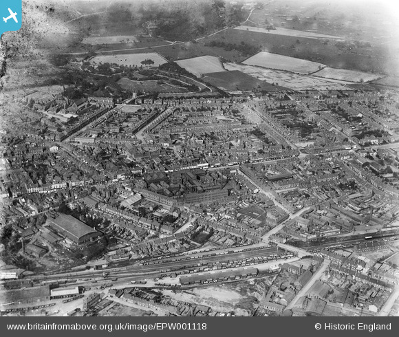
EPW001118 ENGLAND (1920). General view of West Bromwich including High Street and Dartmouth Park, 1920
© Hawlfraint cyfranwyr OpenStreetMap a thrwyddedwyd gan yr OpenStreetMap Foundation. 2024. Trwyddedir y gartograffeg fel CC BY-SA.
Delweddau cyfagos (6)
EPW001118

EPW057562

EPW061254

EPW057565

EPW021861

EPW021863

Manylion
| Pennawd | [EPW001118] General view of West Bromwich including High Street and Dartmouth Park, 1920 |
| Cyfeirnod | EPW001118 |
| Dyddiad | May-1920 |
| Dolen | |
| Enw lle | WEST BROMWICH |
| Plwyf | |
| Ardal | |
| Gwlad | ENGLAND |
| Dwyreiniad / Gogleddiad | 400877, 290883 |
| Hydred / Lledred | -1.9870749465019, 52.515466626256 |
| Cyfeirnod Grid Cenedlaethol | SP009909 |
Pinnau
 kevofbrum |
Monday 22nd of July 2019 09:50:33 AM | |
DaveT |
Tuesday 11th of March 2014 12:25:55 PM | |
scoop115 |
Sunday 22nd of December 2013 08:04:12 PM | |
Lou789 |
Friday 13th of July 2012 11:04:42 PM | |
Lou789 |
Friday 13th of July 2012 11:04:02 PM |


