
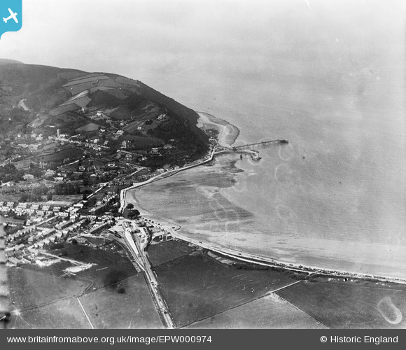
EPW000974 ENGLAND (1920). View of Minehead, Pier and Harbour from the station, Minehead, from the south-east, 1920
© Hawlfraint cyfranwyr OpenStreetMap a thrwyddedwyd gan yr OpenStreetMap Foundation. 2024. Trwyddedir y gartograffeg fel CC BY-SA.
Delweddau cyfagos (3)
EPW000974

EPW033299

EPW039962

Manylion
| Pennawd | [EPW000974] View of Minehead, Pier and Harbour from the station, Minehead, from the south-east, 1920 |
| Cyfeirnod | EPW000974 |
| Dyddiad | May-1920 |
| Dolen | |
| Enw lle | MINEHEAD |
| Plwyf | MINEHEAD |
| Ardal | |
| Gwlad | ENGLAND |
| Dwyreiniad / Gogleddiad | 297675, 146331 |
| Hydred / Lledred | -3.4649385524213, 51.206493616408 |
| Cyfeirnod Grid Cenedlaethol | SS977463 |
Pinnau
 MB |
Tuesday 11th of September 2012 07:12:08 PM | |
MB |
Tuesday 11th of September 2012 07:10:18 PM | |
MB |
Tuesday 11th of September 2012 07:06:48 PM | |
MB |
Tuesday 11th of September 2012 07:04:03 PM | |
Baldwinnut |
Saturday 21st of July 2012 12:18:30 PM | |
Baldwinnut |
Saturday 21st of July 2012 12:17:59 PM |


