
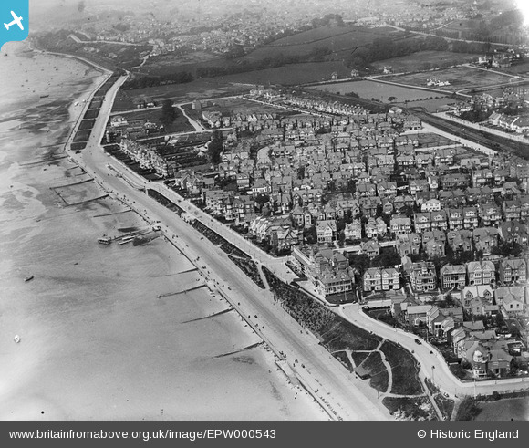
EPW000543 ENGLAND (1920). Westcliff-on-Sea, Southend-on-Sea, 1920
© Hawlfraint cyfranwyr OpenStreetMap a thrwyddedwyd gan yr OpenStreetMap Foundation. 2024. Trwyddedir y gartograffeg fel CC BY-SA.
Delweddau cyfagos (19)
EPW000543

EPW024884

EAW053103

EPW036732

EPW037019

EPW024876

EPW037023

EPW037022

EAW043706

EAW043707

EPW054674

EAW053092

EAW043704

EPW040985

EPW037025

EPW037018

EPW040969

EPW024864

EPW054668

Manylion
| Pennawd | [EPW000543] Westcliff-on-Sea, Southend-on-Sea, 1920 |
| Cyfeirnod | EPW000543 |
| Dyddiad | April-1920 |
| Dolen | |
| Enw lle | WESTCLIFF-ON-SEA |
| Plwyf | |
| Ardal | |
| Gwlad | ENGLAND |
| Dwyreiniad / Gogleddiad | 586408, 185350 |
| Hydred / Lledred | 0.6880848754974, 51.535749773285 |
| Cyfeirnod Grid Cenedlaethol | TQ864854 |
Pinnau
 Wes |
Saturday 15th of February 2020 07:43:39 AM |


