
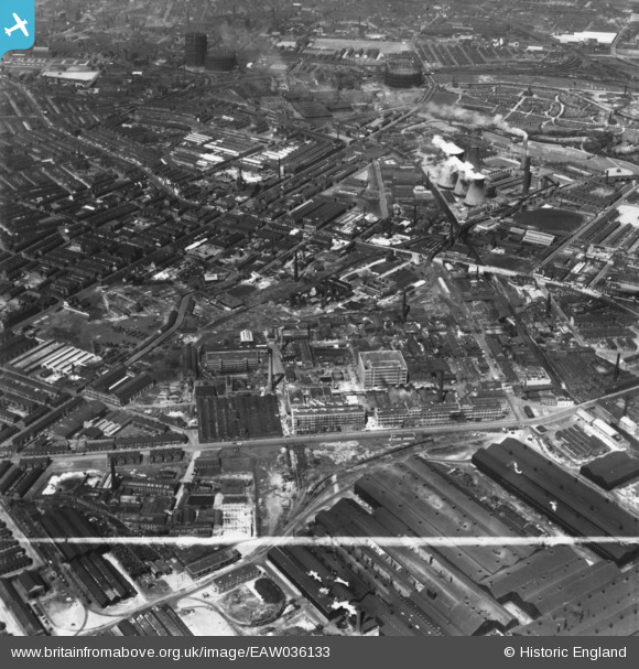
EAW036133 ENGLAND (1951). The Clayton Aniline Chemical Works and environs, Manchester, 1951. This image has been produced from a print marked by Aerofilms Ltd for photo editing.
© Hawlfraint cyfranwyr OpenStreetMap a thrwyddedwyd gan yr OpenStreetMap Foundation. 2024. Trwyddedir y gartograffeg fel CC BY-SA.
Delweddau cyfagos (10)
EAW036133

EAW036134

EAW036138

EAW036130

EAW036129

EAW036137

EAW036135

EAW036132

EAW036131

EAW025658

Manylion
| Pennawd | [EAW036133] The Clayton Aniline Chemical Works and environs, Manchester, 1951. This image has been produced from a print marked by Aerofilms Ltd for photo editing. |
| Cyfeirnod | EAW036133 |
| Dyddiad | 17-May-1951 |
| Dolen | |
| Enw lle | MANCHESTER |
| Plwyf | |
| Ardal | |
| Gwlad | ENGLAND |
| Dwyreiniad / Gogleddiad | 387616, 398212 |
| Hydred / Lledred | -2.1866270836255, 53.480233075947 |
| Cyfeirnod Grid Cenedlaethol | SJ876982 |
Pinnau
 redmist |
Saturday 10th of October 2020 01:00:19 PM | |
Mikeya |
Wednesday 22nd of May 2019 12:10:14 AM | |
Mikeya |
Wednesday 22nd of May 2019 12:09:40 AM | |
 |
J.Smith |
Saturday 12th of January 2019 09:43:39 PM |
 |
J.Smith |
Saturday 12th of January 2019 09:33:56 PM |
stardelta |
Saturday 16th of April 2016 07:54:00 PM |


