
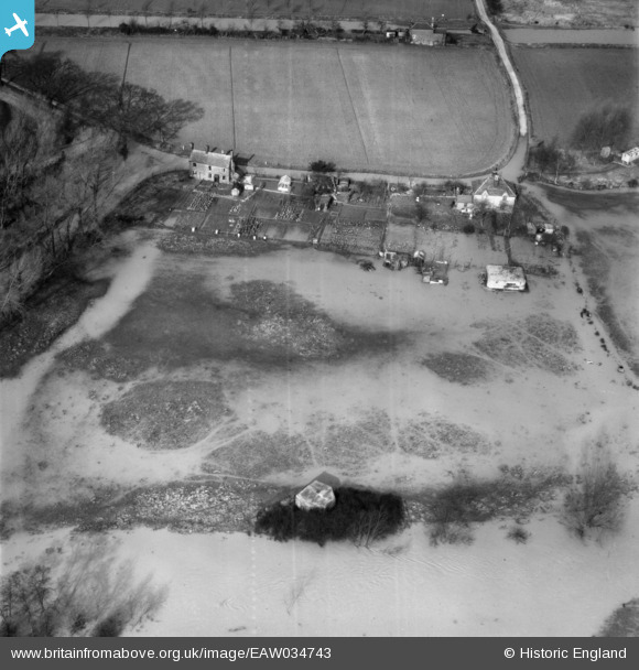
EAW034743 ENGLAND (1951). The River Chelmer in flood to the south of Brook End Road, Chelmsford, 1951
© Hawlfraint cyfranwyr OpenStreetMap a thrwyddedwyd gan yr OpenStreetMap Foundation. 2024. Trwyddedir y gartograffeg fel CC BY-SA.
Delweddau cyfagos (4)
EAW034743

EAW034714

EAW034745

EAW034747

Manylion
| Pennawd | [EAW034743] The River Chelmer in flood to the south of Brook End Road, Chelmsford, 1951 |
| Cyfeirnod | EAW034743 |
| Dyddiad | 21-February-1951 |
| Dolen | |
| Enw lle | CHELMSFORD |
| Plwyf | SPRINGFIELD |
| Ardal | |
| Gwlad | ENGLAND |
| Dwyreiniad / Gogleddiad | 574017, 206133 |
| Hydred / Lledred | 0.51992358730567, 51.726412718262 |
| Cyfeirnod Grid Cenedlaethol | TL740061 |
Pinnau
 cptpies |
Thursday 8th of May 2014 11:28:35 AM | |
Does this pillbox still exist? Useful to know for people wanting to visit. |
 8-2007.JPG) Keith |
Sunday 11th of January 2015 12:45:36 AM |
cptpies |
Thursday 8th of May 2014 11:28:05 AM | |
What about this pillbox too, does it still exist? |
Keith |
Sunday 11th of January 2015 12:46:05 AM |
Ian |
Saturday 26th of April 2014 10:16:34 PM | |
Ian |
Saturday 26th of April 2014 10:14:30 PM | |
Ian |
Saturday 26th of April 2014 10:13:59 PM | |
Ian |
Saturday 26th of April 2014 10:13:21 PM |
Cyfraniadau Grŵp
 Pillboxes on the banks of the Chelmer. |
cptpies |
Thursday 8th of May 2014 11:31:07 AM |


