
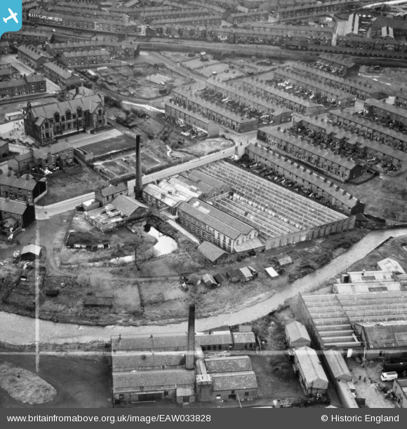
EAW033828 ENGLAND (1950). Primrose Mill, Mill Hill, 1950. This image was marked by Aerofilms Ltd for photo editing.
© Hawlfraint cyfranwyr OpenStreetMap a thrwyddedwyd gan yr OpenStreetMap Foundation. 2024. Trwyddedir y gartograffeg fel CC BY-SA.
Delweddau cyfagos (6)
EAW033828

EAW033829

EAW033830

EAW033827

EAW033826

EAW033825

Manylion
| Pennawd | [EAW033828] Primrose Mill, Mill Hill, 1950. This image was marked by Aerofilms Ltd for photo editing. |
| Cyfeirnod | EAW033828 |
| Dyddiad | 16-October-1950 |
| Dolen | |
| Enw lle | MILL HILL |
| Plwyf | |
| Ardal | |
| Gwlad | ENGLAND |
| Dwyreiniad / Gogleddiad | 366651, 426845 |
| Hydred / Lledred | -2.5056260042354, 53.736702784335 |
| Cyfeirnod Grid Cenedlaethol | SD667268 |
Pinnau
 Matt Aldred edob.mattaldred.com |
Friday 8th of March 2024 06:28:46 PM | |
Matt Aldred edob.mattaldred.com |
Friday 8th of March 2024 06:27:55 PM | |
 powerpop |
Sunday 15th of July 2018 03:19:02 PM | |
powerpop |
Sunday 15th of July 2018 03:15:39 PM | |
powerpop |
Sunday 15th of July 2018 03:15:14 PM | |
powerpop |
Sunday 15th of July 2018 03:14:45 PM | |
powerpop |
Sunday 15th of July 2018 03:14:15 PM | |
 Sparky |
Thursday 7th of September 2017 09:56:30 AM | |
Sparky |
Thursday 7th of September 2017 09:55:01 AM | |
powerpop |
Sunday 17th of January 2016 05:46:45 PM | |
powerpop |
Sunday 17th of January 2016 05:46:22 PM | |
powerpop |
Sunday 17th of January 2016 05:45:48 PM | |
powerpop |
Sunday 17th of January 2016 05:44:42 PM |


