
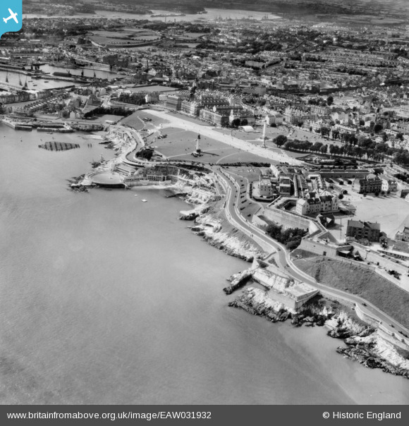
EAW031932 ENGLAND (1950). The Hoe, Madeira Road and the seafront, Plymouth, 1950
© Hawlfraint cyfranwyr OpenStreetMap a thrwyddedwyd gan yr OpenStreetMap Foundation. 2024. Trwyddedir y gartograffeg fel CC BY-SA.
Delweddau cyfagos (5)
EAW031932

EAW031933

EAW053020

EAW053019

EPW054896

Manylion
| Pennawd | [EAW031932] The Hoe, Madeira Road and the seafront, Plymouth, 1950 |
| Cyfeirnod | EAW031932 |
| Dyddiad | 17-August-1950 |
| Dolen | |
| Enw lle | PLYMOUTH |
| Plwyf | |
| Ardal | |
| Gwlad | ENGLAND |
| Dwyreiniad / Gogleddiad | 247909, 53711 |
| Hydred / Lledred | -4.1386288634015, 50.363012487228 |
| Cyfeirnod Grid Cenedlaethol | SX479537 |
Pinnau
 redmist |
Tuesday 15th of December 2020 02:24:34 PM | |
redmist |
Tuesday 15th of December 2020 01:40:10 PM | |
Coventry kid |
Sunday 27th of April 2014 04:55:43 PM | |
Coventry kid |
Sunday 27th of April 2014 04:53:38 PM |


