
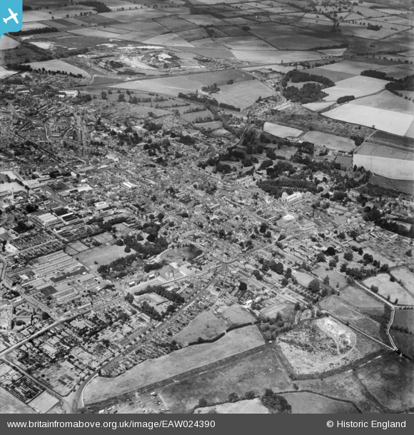
EAW024390 ENGLAND (1949). The town, Bury St Edmunds, from the south-west, 1949
© Hawlfraint cyfranwyr OpenStreetMap a thrwyddedwyd gan yr OpenStreetMap Foundation. 2024. Trwyddedir y gartograffeg fel CC BY-SA.
Manylion
| Pennawd | [EAW024390] The town, Bury St Edmunds, from the south-west, 1949 |
| Cyfeirnod | EAW024390 |
| Dyddiad | 6-July-1949 |
| Dolen | |
| Enw lle | BURY ST EDMUNDS |
| Plwyf | BURY ST. EDMUNDS |
| Ardal | |
| Gwlad | ENGLAND |
| Dwyreiniad / Gogleddiad | 585095, 263686 |
| Hydred / Lledred | 0.71121199401957, 52.239795275803 |
| Cyfeirnod Grid Cenedlaethol | TL851637 |
Pinnau
 Matt Aldred edob.mattaldred.com |
Sunday 8th of November 2020 09:38:20 PM | |
Matt Aldred edob.mattaldred.com |
Sunday 8th of November 2020 09:37:07 PM | |
Matt Aldred edob.mattaldred.com |
Sunday 8th of November 2020 09:36:16 PM | |
 cptpies |
Monday 16th of December 2013 02:00:54 PM |
Cyfraniadau Grŵp
 Type 22 pillbox, Bury St Edmunds. |
cptpies |
Thursday 19th of December 2013 01:56:56 PM |


