
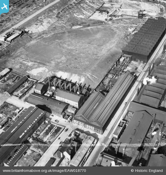
EAW018770 ENGLAND (1948). Recreation ground and adjacent Firth-Vickers Stainless Steels Ltd Atlas Works on Carlisle Street East, Grimesthorpe, 1948. This image was marked by Aerofilms Ltd for photo editing.
© Hawlfraint cyfranwyr OpenStreetMap a thrwyddedwyd gan yr OpenStreetMap Foundation. 2024. Trwyddedir y gartograffeg fel CC BY-SA.
Delweddau cyfagos (23)
EAW018770

EAW018766

EAW020106

EAW018800

EAW020107

EAW018764

EAW018767

EAW018769

EAW020111

EAW020105

EAW020112

EAW020110

EAW018765

EAW018768

EAW018801

EPW041547

EPW041546

EAW020109

EAW020104

EAW009654

EAW020108

EPW041548

EAW009650

Manylion
| Pennawd | [EAW018770] Recreation ground and adjacent Firth-Vickers Stainless Steels Ltd Atlas Works on Carlisle Street East, Grimesthorpe, 1948. This image was marked by Aerofilms Ltd for photo editing. |
| Cyfeirnod | EAW018770 |
| Dyddiad | 21-September-1948 |
| Dolen | |
| Enw lle | GRIMESTHORPE |
| Plwyf | |
| Ardal | |
| Gwlad | ENGLAND |
| Dwyreiniad / Gogleddiad | 437074, 389376 |
| Hydred / Lledred | -1.4423481118187, 53.399645019318 |
| Cyfeirnod Grid Cenedlaethol | SK371894 |


