
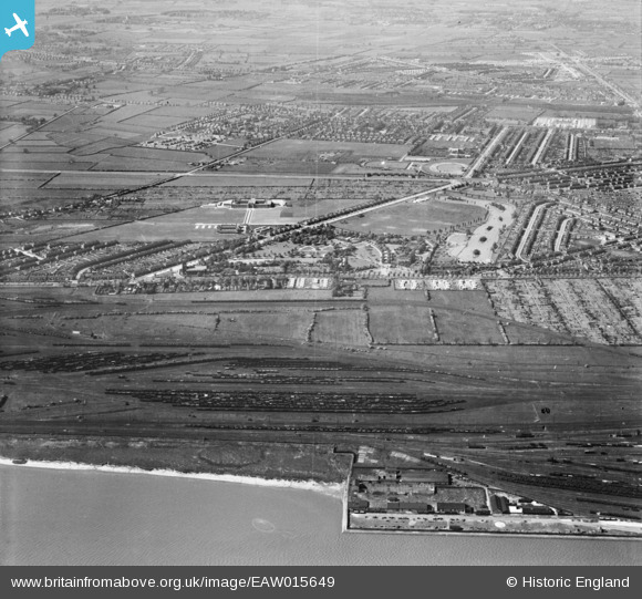
EAW015649 ENGLAND (1948). Pickering Park and Priory Yard Sidings, Gipsyville, 1948
© Hawlfraint cyfranwyr OpenStreetMap a thrwyddedwyd gan yr OpenStreetMap Foundation. 2024. Trwyddedir y gartograffeg fel CC BY-SA.
Delweddau cyfagos (4)
EAW015649

EPW036562

EPW036548

EPW036393

Manylion
| Pennawd | [EAW015649] Pickering Park and Priory Yard Sidings, Gipsyville, 1948 |
| Cyfeirnod | EAW015649 |
| Dyddiad | 18-May-1948 |
| Dolen | |
| Enw lle | GIPSYVILLE |
| Plwyf | |
| Ardal | |
| Gwlad | ENGLAND |
| Dwyreiniad / Gogleddiad | 505601, 427040 |
| Hydred / Lledred | -0.39915718141473, 53.728829549535 |
| Cyfeirnod Grid Cenedlaethol | TA056270 |
Pinnau
 redmist |
Monday 18th of October 2021 02:40:36 PM | |
redmist |
Monday 18th of October 2021 02:39:41 PM | |
redmist |
Monday 18th of October 2021 02:12:51 PM | |
redmist |
Monday 18th of October 2021 02:12:30 PM | |
redmist |
Friday 11th of January 2019 06:10:40 PM | |
redmist |
Friday 11th of January 2019 06:08:15 PM | |
redmist |
Friday 11th of January 2019 06:05:07 PM |


