
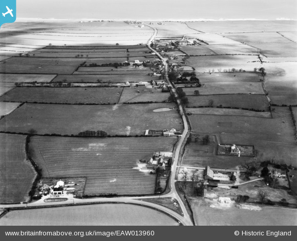
EAW013960 ENGLAND (1948). Sands Lane, Barmston, from the west, 1948
© Hawlfraint cyfranwyr OpenStreetMap a thrwyddedwyd gan yr OpenStreetMap Foundation. 2024. Trwyddedir y gartograffeg fel CC BY-SA.
Delweddau cyfagos (3)
EAW013960

EAW013959

EAW013958

Manylion
| Pennawd | [EAW013960] Sands Lane, Barmston, from the west, 1948 |
| Cyfeirnod | EAW013960 |
| Dyddiad | 23-March-1948 |
| Dolen | |
| Enw lle | BARMSTON |
| Plwyf | BARMSTON |
| Ardal | |
| Gwlad | ENGLAND |
| Dwyreiniad / Gogleddiad | 515675, 459018 |
| Hydred / Lledred | -0.23445506068361, 54.014004311581 |
| Cyfeirnod Grid Cenedlaethol | TA157590 |
Pinnau
 Matt Aldred edob.mattaldred.com |
Sunday 29th of November 2020 07:49:09 PM | |
Matt Aldred edob.mattaldred.com |
Sunday 29th of November 2020 07:48:55 PM | |
Matt Aldred edob.mattaldred.com |
Sunday 29th of November 2020 07:48:45 PM | |
Matt Aldred edob.mattaldred.com |
Sunday 29th of November 2020 07:48:34 PM | |
Matt Aldred edob.mattaldred.com |
Sunday 29th of November 2020 07:48:20 PM | |
 redmist |
Wednesday 8th of April 2020 11:19:08 PM | |
redmist |
Wednesday 8th of April 2020 11:18:33 PM | |
redmist |
Wednesday 8th of April 2020 11:18:06 PM | |
redmist |
Wednesday 8th of April 2020 11:16:56 PM | |
redmist |
Wednesday 8th of April 2020 11:16:38 PM | |
redmist |
Wednesday 8th of April 2020 11:16:24 PM | |
redmist |
Wednesday 8th of April 2020 11:15:53 PM | |
Chris Kolonko |
Tuesday 12th of September 2017 10:37:12 PM |


