
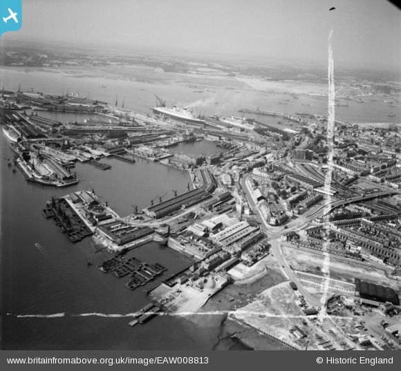
EAW008813 ENGLAND (1947). The docks, Southampton, from the north-east, 1947. This image was marked by Aerofilms Ltd for photo editing.
© Hawlfraint cyfranwyr OpenStreetMap a thrwyddedwyd gan yr OpenStreetMap Foundation. 2024. Trwyddedir y gartograffeg fel CC BY-SA.
Delweddau cyfagos (9)
EAW008813

EAW008787

EAW008786

EAW008789

EAW008790

EAW008788

EAW283939

EAW008806

EPW020441

Manylion
| Pennawd | [EAW008813] The docks, Southampton, from the north-east, 1947. This image was marked by Aerofilms Ltd for photo editing. |
| Cyfeirnod | EAW008813 |
| Dyddiad | 9-August-1947 |
| Dolen | |
| Enw lle | SOUTHAMPTON |
| Plwyf | |
| Ardal | |
| Gwlad | ENGLAND |
| Dwyreiniad / Gogleddiad | 443074, 111117 |
| Hydred / Lledred | -1.3874335680635, 50.89737023523 |
| Cyfeirnod Grid Cenedlaethol | SU431111 |
Pinnau
 Class31 |
Saturday 31st of May 2014 08:28:42 AM | |
 MB |
Sunday 17th of November 2013 09:31:21 AM | |
A "Weapon"-class destoyer, HMS "Crossbow" or "Scorpion", former was built at Woolston by Thornycroft so is most likely |
Andy A |
Wednesday 15th of January 2014 08:40:19 PM |
MB |
Sunday 17th of November 2013 09:29:02 AM | |
MB |
Sunday 17th of November 2013 09:27:55 AM | |
MB |
Sunday 17th of November 2013 09:26:38 AM | |
MB |
Sunday 17th of November 2013 09:23:20 AM |
Cyfraniadau Grŵp
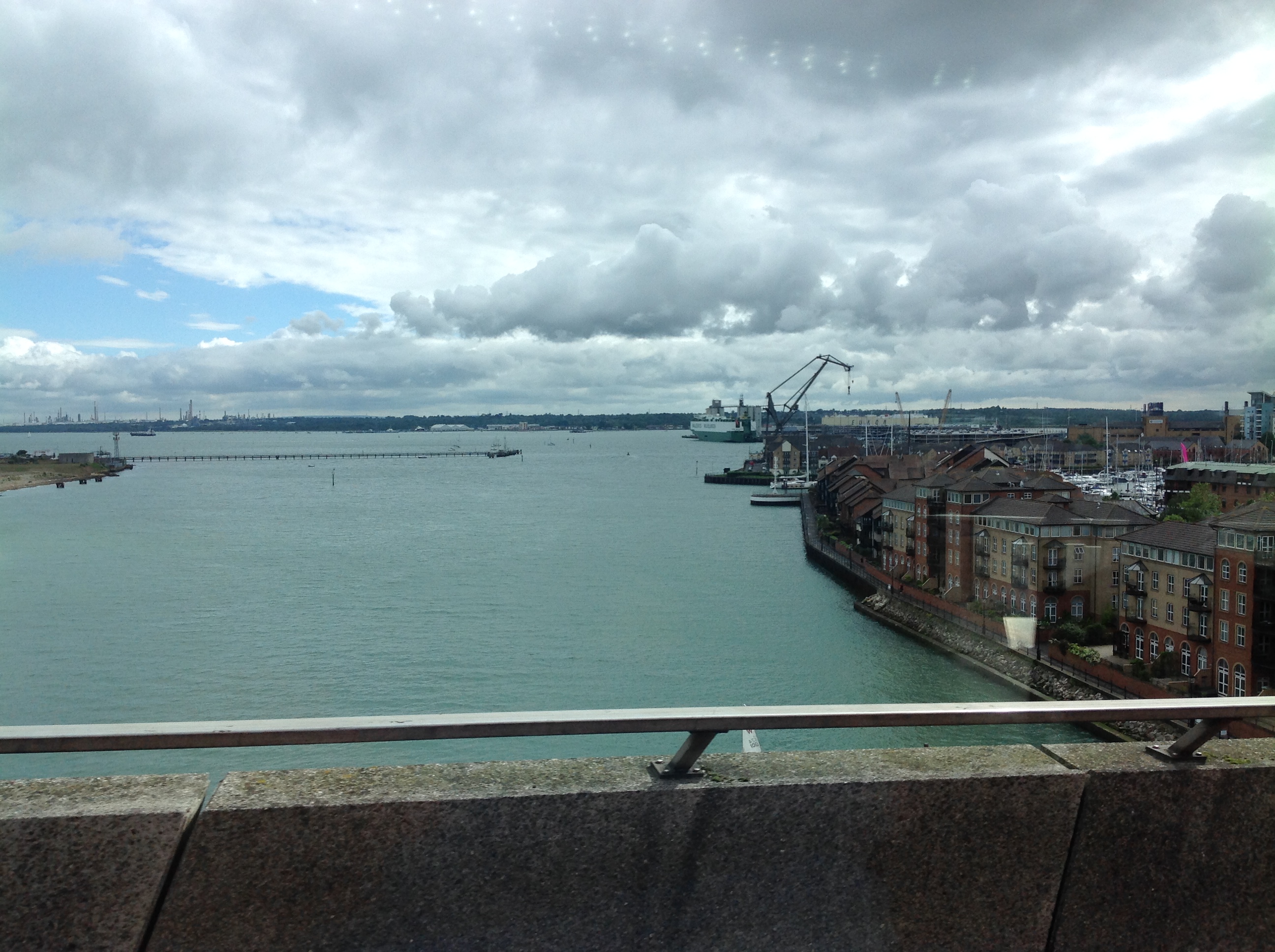 View from the Itchen Bridge, looking south, Southampton 29/05/2014 |
Class31 |
Saturday 31st of May 2014 08:30:21 AM |


