
EAW008403 ENGLAND (1947). St Peter and St Paul's Church, Newport Pagnell, 1947
© Hawlfraint cyfranwyr OpenStreetMap a thrwyddedwyd gan yr OpenStreetMap Foundation. 2024. Trwyddedir y gartograffeg fel CC BY-SA.
Delweddau cyfagos (4)
EAW008403

EAW008404

EAW008405

EPW022490

Manylion
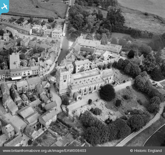
| Pennawd | [EAW008403] St Peter and St Paul's Church, Newport Pagnell, 1947 |
| Cyfeirnod | EAW008403 |
| Dyddiad | 20-July-1947 |
| Dolen | |
| Enw lle | NEWPORT PAGNELL |
| Plwyf | NEWPORT PAGNELL |
| Ardal | |
| Gwlad | ENGLAND |
| Dwyreiniad / Gogleddiad | 487786, 243958 |
| Hydred / Lledred | -0.71864026283855, 52.086587770029 |
| Cyfeirnod Grid Cenedlaethol | SP878440 |
Pinnau
 Paulf1976 |
Wednesday 3rd of August 2016 01:11:24 PM | |
 melgibbs |
Wednesday 4th of March 2015 08:24:30 PM | |
 |
melgibbs |
Wednesday 4th of March 2015 06:23:21 PM |
Richard Dawson |
Saturday 27th of September 2014 01:06:05 PM | |
Richard Dawson |
Saturday 27th of September 2014 01:04:51 PM | |
Richard Dawson |
Thursday 11th of September 2014 06:42:31 PM | |
Richard Dawson |
Thursday 11th of September 2014 06:41:47 PM | |
Richard Dawson |
Tuesday 9th of September 2014 07:01:35 PM | |
Richard Dawson |
Tuesday 9th of September 2014 07:00:06 PM | |
Richard Dawson |
Tuesday 9th of September 2014 06:59:42 PM | |
Richard Dawson |
Tuesday 9th of September 2014 06:58:23 PM | |
Richard Dawson |
Tuesday 9th of September 2014 06:57:49 PM | |
Lynda Tubbs |
Wednesday 30th of April 2014 03:20:01 PM |

Cyfraniadau Grŵp
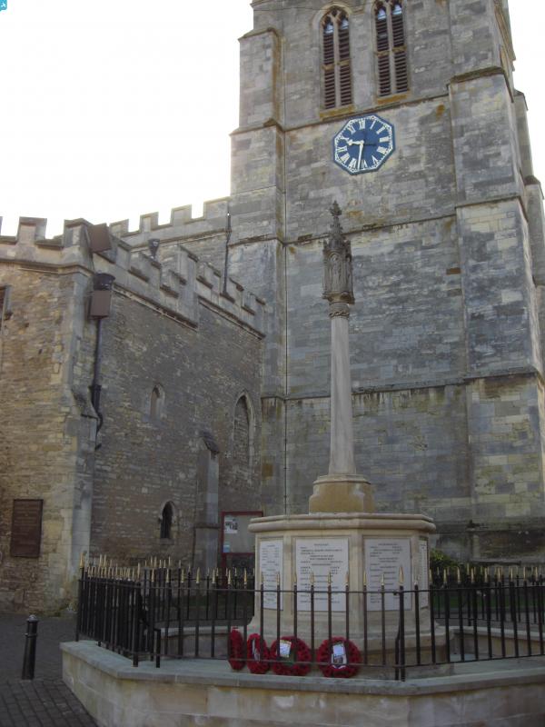
 This is a small memorial tucked away near the church entrance. The new octagonal base has memorial slabs on each face. |
melgibbs |
Wednesday 4th of March 2015 08:26:34 PM |


