
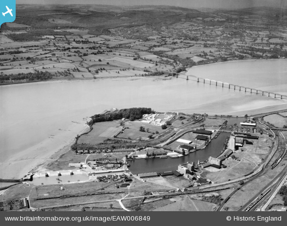
EAW006849 ENGLAND (1947). Sharpness Docks and the Severn Railway Bridge, Sharpness, from the south, 1947
© Hawlfraint cyfranwyr OpenStreetMap a thrwyddedwyd gan yr OpenStreetMap Foundation. 2024. Trwyddedir y gartograffeg fel CC BY-SA.
Delweddau cyfagos (8)
EAW006849

EAW012141

EAW012138

EPW029346

EPW037752

EPW005400

EPW005401

EPW029343

Manylion
| Pennawd | [EAW006849] Sharpness Docks and the Severn Railway Bridge, Sharpness, from the south, 1947 |
| Cyfeirnod | EAW006849 |
| Dyddiad | 10-June-1947 |
| Dolen | |
| Enw lle | SHARPNESS |
| Plwyf | HINTON |
| Ardal | |
| Gwlad | ENGLAND |
| Dwyreiniad / Gogleddiad | 367031, 202619 |
| Hydred / Lledred | -2.477328117567, 51.720866922136 |
| Cyfeirnod Grid Cenedlaethol | SO670026 |
Pinnau
 MB |
Monday 22nd of August 2016 02:49:41 PM | |
MB |
Monday 22nd of August 2016 02:48:50 PM | |
MB |
Monday 22nd of August 2016 02:47:37 PM | |
gBr |
Friday 28th of November 2014 10:44:39 PM | |
gBr |
Friday 28th of November 2014 10:42:21 PM | |
Louis |
Wednesday 12th of November 2014 08:37:48 PM |


