
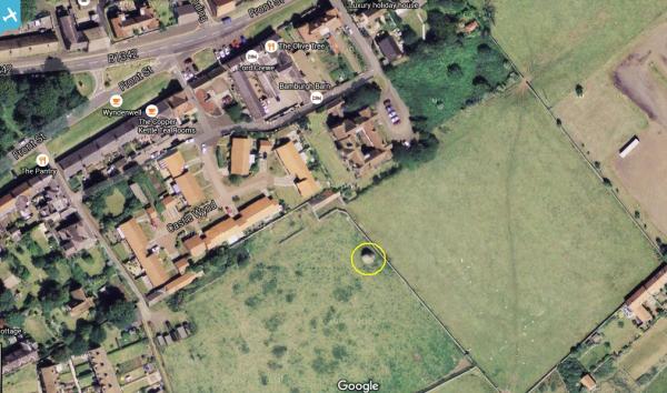
EAW006088 ENGLAND (1947). Bamburgh Castle and the Castle Green, Bamburgh, from the south-west, 1947

© Hawlfraint cyfranwyr OpenStreetMap a thrwyddedwyd gan yr OpenStreetMap Foundation. 2024. Trwyddedir y gartograffeg fel CC BY-SA.
Delweddau cyfagos (12)
EAW006088

EAW006092

EAW034342

EAW034343

EAW006091

EAW006089

EAW034344

EAW006093

EAW034345

EAW006090

EAW034346

EAW034347

Manylion
| Pennawd | [EAW006088] Bamburgh Castle and the Castle Green, Bamburgh, from the south-west, 1947 |
| Cyfeirnod | EAW006088 |
| Dyddiad | 21-May-1947 |
| Dolen | |
| Enw lle | BAMBURGH |
| Plwyf | BAMBURGH |
| Ardal | |
| Gwlad | ENGLAND |
| Dwyreiniad / Gogleddiad | 418257, 635072 |
| Hydred / Lledred | -1.7101601512886, 55.608910055251 |
| Cyfeirnod Grid Cenedlaethol | NU183351 |
Pinnau
 Matt Aldred edob.mattaldred.com |
Thursday 31st of December 2020 03:50:16 PM | |
Matt Aldred edob.mattaldred.com |
Thursday 31st of December 2020 03:49:58 PM | |
Matt Aldred edob.mattaldred.com |
Thursday 31st of December 2020 03:49:39 PM | |
 redmist |
Thursday 31st of October 2019 12:05:07 AM | |
redmist |
Wednesday 30th of October 2019 11:29:12 PM | |
Mark P |
Tuesday 14th of November 2017 09:26:22 PM | |
 |
 melgibbs |
Monday 11th of April 2016 04:48:51 PM |
 |
melgibbs |
Wednesday 22nd of October 2014 07:15:11 PM |
 |
melgibbs |
Monday 16th of December 2013 06:39:22 PM |
 |
melgibbs |
Saturday 14th of December 2013 11:19:09 AM |
melgibbs |
Saturday 14th of December 2013 11:07:52 AM | |
melgibbs |
Saturday 14th of December 2013 11:01:26 AM | |
melgibbs |
Friday 13th of December 2013 07:03:23 PM | |
melgibbs |
Friday 13th of December 2013 07:02:29 PM | |
melgibbs |
Friday 13th of December 2013 07:01:58 PM | |
melgibbs |
Friday 13th of December 2013 07:01:27 PM |
Cyfraniadau Grŵp
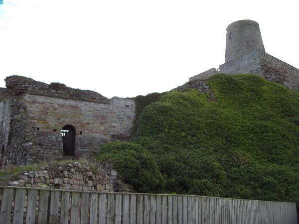
Shipwrecks were common on this stretch of coastline and a Dr John Sharp (1722 - 1792) who was resident at the castle founded what is recognised as the first coastguard system in the world. More can be read at http://bamburgh.org.uk/news/did-bamburgh-shipwreck-inspire-first-coastguards-/ and http://www.bamburghcastle.com/history_more.php?id=57 |
melgibbs |
Sunday 30th of October 2016 06:39:16 PM |
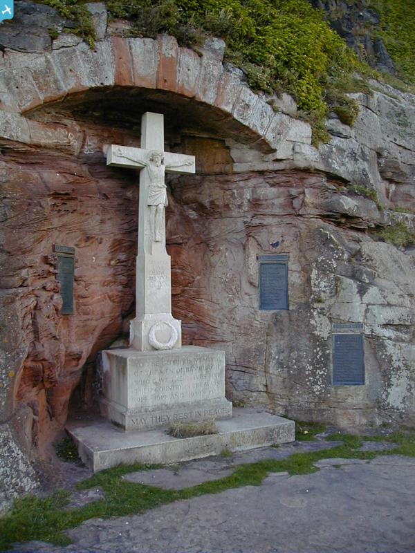
 The setting for these memorials is slightly more unusual as they are in the base of Bamburgh Castle. |
melgibbs |
Wednesday 16th of April 2014 04:53:01 PM |
See also image EAW006092. |
melgibbs |
Saturday 14th of December 2013 10:59:38 AM |


