
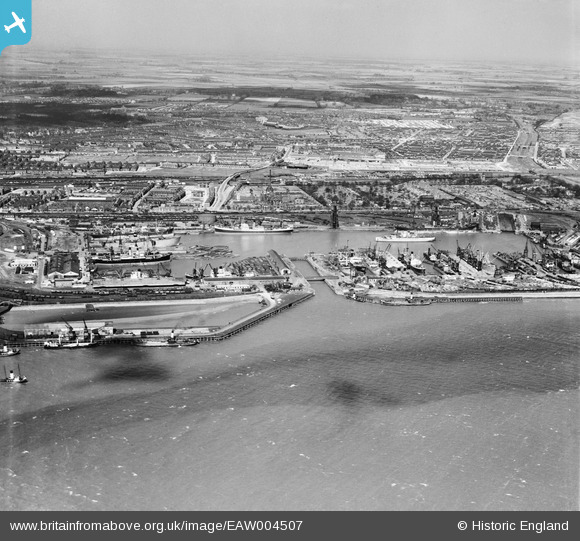
EAW004507 ENGLAND (1947). Alexandra Dock and environs, Kingston upon Hull, from the south, 1947
© Hawlfraint cyfranwyr OpenStreetMap a thrwyddedwyd gan yr OpenStreetMap Foundation. 2024. Trwyddedir y gartograffeg fel CC BY-SA.
Delweddau cyfagos (7)
EAW004507

EPW036406

EPW036379

EAW046142

EPW036427

EAW324975

EPW036392

Manylion
| Pennawd | [EAW004507] Alexandra Dock and environs, Kingston upon Hull, from the south, 1947 |
| Cyfeirnod | EAW004507 |
| Dyddiad | 16-April-1947 |
| Dolen | |
| Enw lle | KINGSTON UPON HULL |
| Plwyf | |
| Ardal | |
| Gwlad | ENGLAND |
| Dwyreiniad / Gogleddiad | 512372, 428516 |
| Hydred / Lledred | -0.29602521040899, 53.740676829998 |
| Cyfeirnod Grid Cenedlaethol | TA124285 |


