
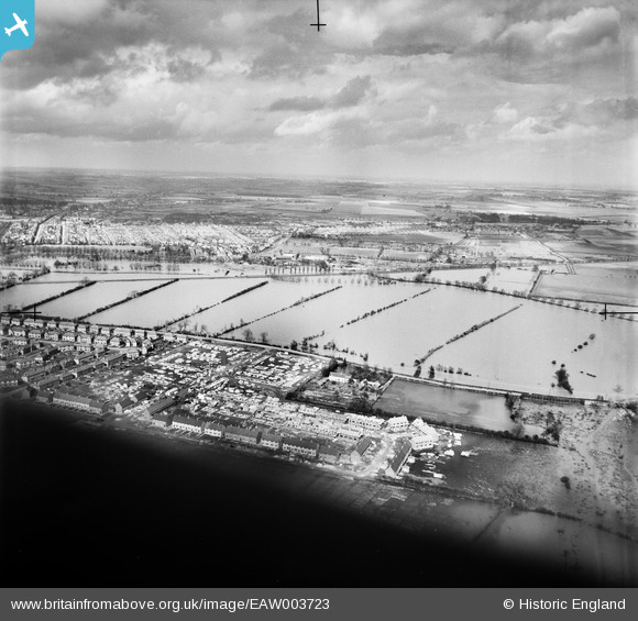
EAW003723 ENGLAND (1947). The River Great Ouse in flood around the residential area of Fenlake and the Fenlake Meadows, Bedford, from the south, 1947
© Hawlfraint cyfranwyr OpenStreetMap a thrwyddedwyd gan yr OpenStreetMap Foundation. 2024. Trwyddedir y gartograffeg fel CC BY-SA.
Manylion
| Pennawd | [EAW003723] The River Great Ouse in flood around the residential area of Fenlake and the Fenlake Meadows, Bedford, from the south, 1947 |
| Cyfeirnod | EAW003723 |
| Dyddiad | 18-March-1947 |
| Dolen | |
| Enw lle | BEDFORD |
| Plwyf | |
| Ardal | |
| Gwlad | ENGLAND |
| Dwyreiniad / Gogleddiad | 506437, 248472 |
| Hydred / Lledred | -0.44509085977041, 52.123888100123 |
| Cyfeirnod Grid Cenedlaethol | TL064485 |
Pinnau
 melgibbs |
Tuesday 10th of December 2013 08:07:01 PM | |
melgibbs |
Tuesday 10th of December 2013 08:06:27 PM | |
melgibbs |
Tuesday 10th of December 2013 08:05:59 PM | |
melgibbs |
Tuesday 10th of December 2013 08:05:22 PM | |
melgibbs |
Saturday 24th of August 2013 11:04:24 AM | |
melgibbs |
Saturday 24th of August 2013 11:01:00 AM |


