
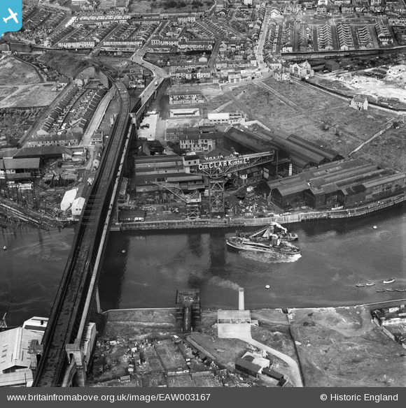
EAW003167 ENGLAND (1946). The Richardsons, Westgarth and Co Marine Engineering Works (G. Clark Ltd) alongside Queen Alexandra Bridge, Sunderland, 1946
© Hawlfraint cyfranwyr OpenStreetMap a thrwyddedwyd gan yr OpenStreetMap Foundation. 2024. Trwyddedir y gartograffeg fel CC BY-SA.
Delweddau cyfagos (18)
EAW003167
 alongside Queen Alexandra Bridge, Sunderland, 1946")
EAW001032

EAW003150
 alongside Queen Alexandra Bridge, Sunderland, from the north-east, 1946")
EAW003164
, Sunderland, from the south-east, 1946")
EAW003163
, Sunderland, 1946")
EAW003165
, Sunderland, 1946")
EAW003169
 alongside the Queen Alexandra Bridge, Sunderland, 1946")
EAW003153
, Queen Alexandra Bridge and the surrounding industrial area, Sunderland, 1946")
EAW003162
 and the surrounding industrial area, Sunderland, from the west, 1946")
EAW003168
 and the surrounding residential area, Sunderland, 1946")
EAW003154
, Queen Alexandra Bridge and the surrounding industrial area, Sunderland, 1946")
EAW003166
 alongside Queen Alexandra Bridge, Sunderland, 1946")
EPW054629

EAW003155
, Queen Alexandra Bridge and the surrounding area, Sunderland, 1946")
EAW003151
 alongside Queen Alexandra Bridge, Sunderland, 1946")
EAW003156
 alongside Queen Alexandra Bridge, Sunderland, 1946")
EAW003152
, Queen Alexandra Bridge and the surrounding residential area, Sunderland, 1946")
EPW006528

Manylion
| Pennawd | [EAW003167] The Richardsons, Westgarth and Co Marine Engineering Works (G. Clark Ltd) alongside Queen Alexandra Bridge, Sunderland, 1946 |
| Cyfeirnod | EAW003167 |
| Dyddiad | 23-October-1946 |
| Dolen | |
| Enw lle | SUNDERLAND |
| Plwyf | |
| Ardal | |
| Gwlad | ENGLAND |
| Dwyreiniad / Gogleddiad | 438236, 557927 |
| Hydred / Lledred | -1.40347496537, 54.914499548828 |
| Cyfeirnod Grid Cenedlaethol | NZ382579 |
Pinnau
 Matt Aldred edob.mattaldred.com |
Thursday 19th of May 2022 02:37:54 PM | |
 Sparky |
Wednesday 13th of September 2017 10:04:43 AM | |
N Dunn |
Sunday 22nd of September 2013 11:25:08 AM | |
N Dunn |
Sunday 22nd of September 2013 11:24:20 AM |


