
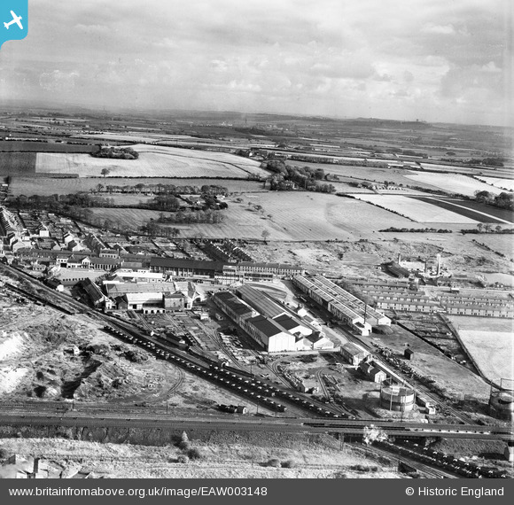
EAW003148 ENGLAND (1946). The Birtley Iron Co Ltd Works and the surrounding countryside, Birtley, from the west, 1946
© Hawlfraint cyfranwyr OpenStreetMap a thrwyddedwyd gan yr OpenStreetMap Foundation. 2024. Trwyddedir y gartograffeg fel CC BY-SA.
Delweddau cyfagos (14)
EAW003148

EAW003143

EAW003145

EAW003142

EAW003141

EAW003146

EAW003138

EAW003139

EAW003140

EAW003137

EAW003136

EAW003149

EAW003144

EAW003147

Manylion
| Pennawd | [EAW003148] The Birtley Iron Co Ltd Works and the surrounding countryside, Birtley, from the west, 1946 |
| Cyfeirnod | EAW003148 |
| Dyddiad | 23-October-1946 |
| Dolen | |
| Enw lle | BIRTLEY |
| Plwyf | |
| Ardal | |
| Gwlad | ENGLAND |
| Dwyreiniad / Gogleddiad | 427011, 555086 |
| Hydred / Lledred | -1.5788578973066, 54.88970045525 |
| Cyfeirnod Grid Cenedlaethol | NZ270551 |
Pinnau
 Ebo77 |
Saturday 30th of October 2021 01:56:34 PM | |
Ebo77 |
Saturday 30th of October 2021 01:56:00 PM | |
 Matt Aldred edob.mattaldred.com |
Saturday 15th of May 2021 06:24:12 PM | |
Matt Aldred edob.mattaldred.com |
Monday 8th of March 2021 06:45:31 PM | |
Ebo77 |
Thursday 3rd of October 2019 07:04:35 PM | |
Ebo77 |
Thursday 3rd of October 2019 07:04:12 PM | |
Sparky |
Friday 15th of September 2017 09:32:19 AM | |
Sparky |
Friday 15th of September 2017 09:31:27 AM |


