
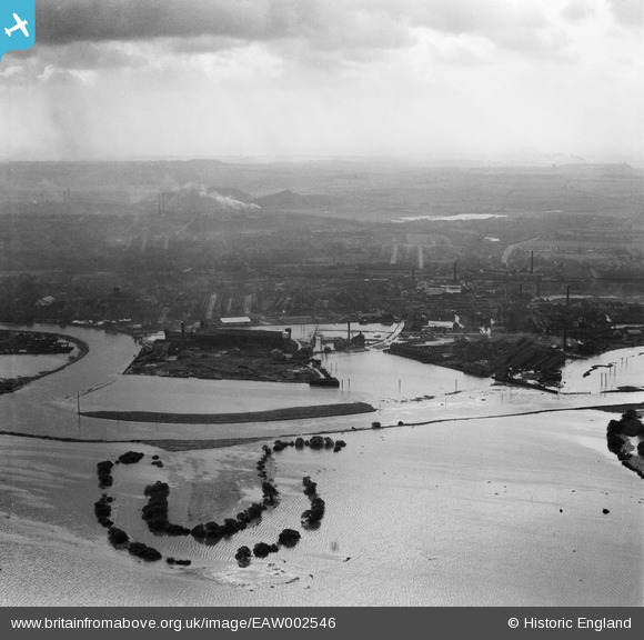
EAW002546 ENGLAND (1946). Flooded fields around an oxbow lake to the west of the confluence of the Rivers Aire and Calder, Castleford, from the north, 1946
© Hawlfraint cyfranwyr OpenStreetMap a thrwyddedwyd gan yr OpenStreetMap Foundation. 2024. Trwyddedir y gartograffeg fel CC BY-SA.
Delweddau cyfagos (2)
EAW002546

EAW002543

Manylion
| Pennawd | [EAW002546] Flooded fields around an oxbow lake to the west of the confluence of the Rivers Aire and Calder, Castleford, from the north, 1946 |
| Cyfeirnod | EAW002546 |
| Dyddiad | 21-September-1946 |
| Dolen | |
| Enw lle | CASTLEFORD |
| Plwyf | |
| Ardal | |
| Gwlad | ENGLAND |
| Dwyreiniad / Gogleddiad | 442132, 426122 |
| Hydred / Lledred | -1.3613158635331, 53.729568320923 |
| Cyfeirnod Grid Cenedlaethol | SE421261 |
Pinnau
Cyfraniadau Grŵp
Difficult to pinpoint landmarks through the soot and the grime. All the industries of Castleford, Collieries, Chemical Works, Glassworks. Brickworks, sweet manufacture and Potteries all now resigned to the history books. |
 Derekdye |
Sunday 17th of November 2013 09:15:45 PM |


