
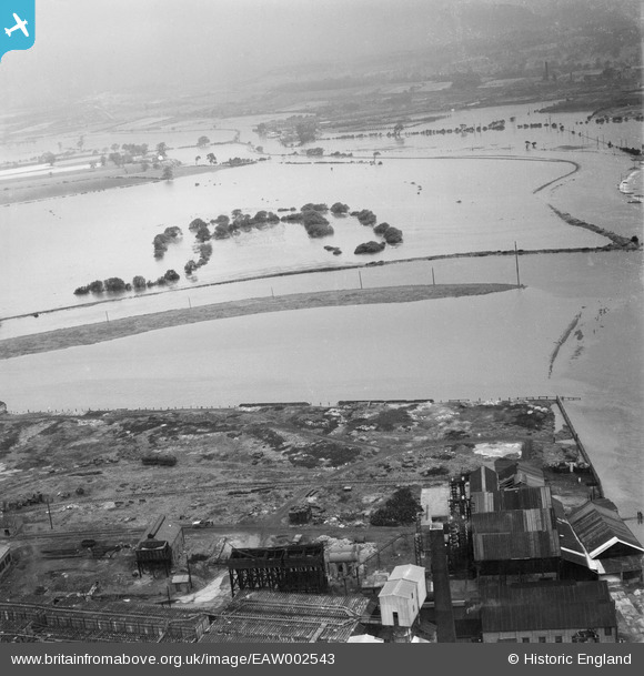
EAW002543 ENGLAND (1946). Flooded fields around an oxbow lake to the west of the confluence of the Rivers Aire and Calder, Castleford, 1946
© Hawlfraint cyfranwyr OpenStreetMap a thrwyddedwyd gan yr OpenStreetMap Foundation. 2024. Trwyddedir y gartograffeg fel CC BY-SA.
Delweddau cyfagos (2)
EAW002543

EAW002546

Manylion
| Pennawd | [EAW002543] Flooded fields around an oxbow lake to the west of the confluence of the Rivers Aire and Calder, Castleford, 1946 |
| Cyfeirnod | EAW002543 |
| Dyddiad | 21-September-1946 |
| Dolen | |
| Enw lle | CASTLEFORD |
| Plwyf | |
| Ardal | |
| Gwlad | ENGLAND |
| Dwyreiniad / Gogleddiad | 442212, 426293 |
| Hydred / Lledred | -1.3600798755254, 53.731098894643 |
| Cyfeirnod Grid Cenedlaethol | SE422263 |
Pinnau
Byddwch y cyntaf i ychwanegu sylw at y ddelwedd hon!


