
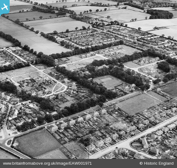
EAW001971 ENGLAND (1946). The Cottage Public House and environs, Thorpe St Andrew, 1946
© Hawlfraint cyfranwyr OpenStreetMap a thrwyddedwyd gan yr OpenStreetMap Foundation. 2024. Trwyddedir y gartograffeg fel CC BY-SA.
Delweddau cyfagos (8)
EAW001971

EAW001965

EAW001969

EAW001970

EAW001968

EAW001967

EAW001966

EAW001964

Manylion
| Pennawd | [EAW001971] The Cottage Public House and environs, Thorpe St Andrew, 1946 |
| Cyfeirnod | EAW001971 |
| Dyddiad | 25-July-1946 |
| Dolen | |
| Enw lle | THORPE ST ANDREW |
| Plwyf | THORPE ST. ANDREW |
| Ardal | |
| Gwlad | ENGLAND |
| Dwyreiniad / Gogleddiad | 626381, 309821 |
| Hydred / Lledred | 1.3462096817598, 52.638472621447 |
| Cyfeirnod Grid Cenedlaethol | TG264098 |
Pinnau
 Matt Aldred edob.mattaldred.com |
Saturday 19th of March 2022 06:25:08 PM | |
 Chris Kolonko |
Tuesday 12th of September 2017 10:54:31 PM | |
Chris Kolonko |
Tuesday 12th of September 2017 10:53:44 PM | |
Chris Kolonko |
Wednesday 9th of August 2017 06:49:46 PM | |
Chris Kolonko |
Wednesday 9th of August 2017 06:49:25 PM | |
Chris Kolonko |
Wednesday 9th of August 2017 06:48:58 PM |


