
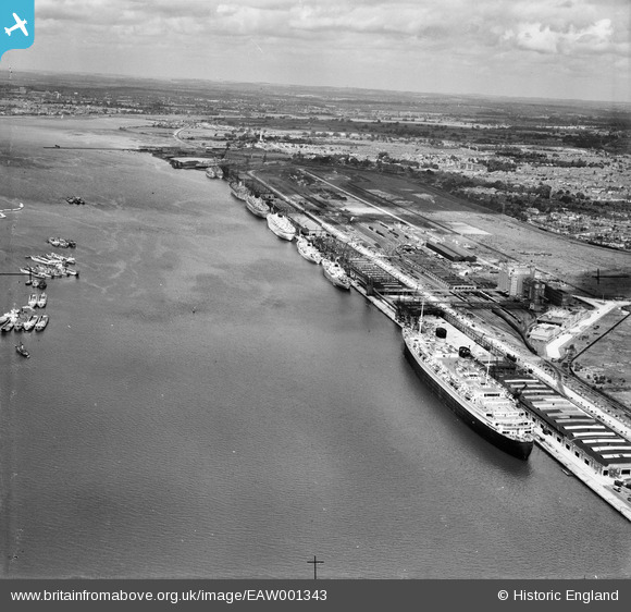
EAW001343 ENGLAND (1946). RMS Queen Elizabth at the New Docks (Western Docks), Southampton, from the south-east, 1946
© Hawlfraint cyfranwyr OpenStreetMap a thrwyddedwyd gan yr OpenStreetMap Foundation. 2024. Trwyddedir y gartograffeg fel CC BY-SA.
Delweddau cyfagos (16)
EAW001343
, Southampton, from the south-east, 1946")
EAW001339
, Southampton, from the south-east, 1946")
EAW002824
, Southampton, from the south, 1946")
EAW001362
, Southampton, 1946")
EAW001364
, Southampton, 1946")
EAW035614
 moored alongside the Passenger and Goods Shed No 101, Southampton, 1951")
EAW001363
, Southampton, from the south-west, 1946")
EAW001367
, Southampton, 1946")
EAW001337
, Southampton, from the south-east, 1946")
EAW001360
, Southampton, from the north-west, 1946")
EAW035612
 moored alongside the Passenger and Goods Shed No 101, Southampton, 1951")
EAW001365
, Southampton, from the south-west, 1946")
EAW002825
 and RMS Queen Elizabeth at the New Docks (Western Docks), Southampton, from the south, 1946")
EAW035613
 moored alongside the Passenger and Goods Shed No 101, Southampton, 1951")
EAW001356
, Southampton, from the north-west, 1946")
EAW001366
, Southampton, 1946")
Manylion
| Pennawd | [EAW001343] RMS Queen Elizabth at the New Docks (Western Docks), Southampton, from the south-east, 1946 |
| Cyfeirnod | EAW001343 |
| Dyddiad | 28-June-1946 |
| Dolen | |
| Enw lle | SOUTHAMPTON |
| Plwyf | |
| Ardal | |
| Gwlad | ENGLAND |
| Dwyreiniad / Gogleddiad | 441036, 111255 |
| Hydred / Lledred | -1.4163993310223, 50.89875973083 |
| Cyfeirnod Grid Cenedlaethol | SU410113 |
Pinnau
 redmist |
Wednesday 21st of December 2022 01:37:06 PM | |
redmist |
Wednesday 21st of December 2022 01:36:37 PM | |
redmist |
Wednesday 21st of December 2022 01:36:12 PM | |
redmist |
Wednesday 21st of December 2022 01:35:49 PM |
Cyfraniadau Grŵp
 Western Docks, Southampton, 12/02/2015 |
 Class31 |
Thursday 12th of February 2015 08:41:07 PM |


