
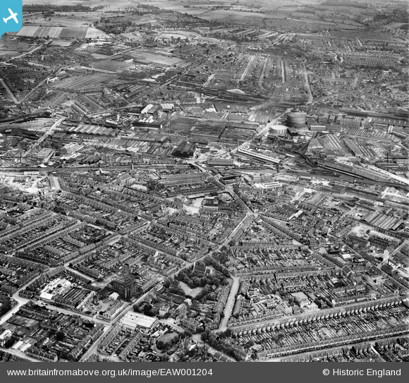
EAW001204 ENGLAND (1946). The industrial and residential area surrounding Windmill Lane and Rabone Lane, Soho, 1946
© Hawlfraint cyfranwyr OpenStreetMap a thrwyddedwyd gan yr OpenStreetMap Foundation. 2024. Trwyddedir y gartograffeg fel CC BY-SA.
Delweddau cyfagos (7)
EAW001204

EAW001205

EPW053086

EPW053090

EPW053080

EPW053089

EPW053079

Manylion
| Pennawd | [EAW001204] The industrial and residential area surrounding Windmill Lane and Rabone Lane, Soho, 1946 |
| Cyfeirnod | EAW001204 |
| Dyddiad | 24-June-1946 |
| Dolen | |
| Enw lle | SOHO |
| Plwyf | |
| Ardal | |
| Gwlad | ENGLAND |
| Dwyreiniad / Gogleddiad | 403089, 288600 |
| Hydred / Lledred | -1.9544961340042, 52.494932200189 |
| Cyfeirnod Grid Cenedlaethol | SP031886 |
Pinnau
 Matt Aldred edob.mattaldred.com |
Thursday 7th of March 2024 10:44:47 AM | |
Matt Aldred edob.mattaldred.com |
Sunday 20th of August 2023 03:14:34 PM | |
Matt Aldred edob.mattaldred.com |
Sunday 20th of August 2023 03:13:47 PM |


