
EAW000728 ENGLAND (1946). Northgate Street, Southgate Street and environs, Gloucester, 1946

© Hawlfraint cyfranwyr OpenStreetMap a thrwyddedwyd gan yr OpenStreetMap Foundation. 2024. Trwyddedir y gartograffeg fel CC BY-SA.
Delweddau cyfagos (9)
EAW000728

EPW024169

EPW037835

EPW006016

EAW018729

EAW000727

EPW024106

EAW000726

EPW024165

Manylion
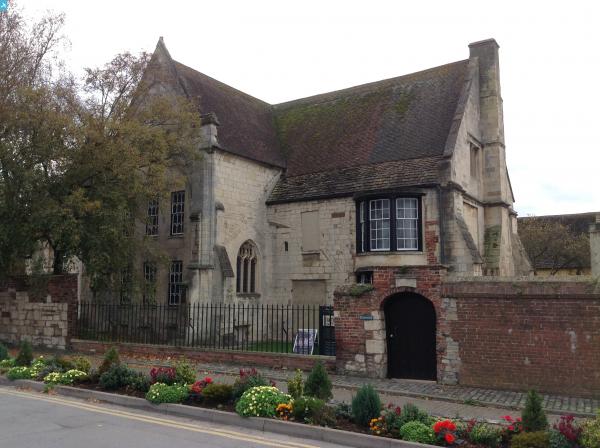
| Pennawd | [EAW000728] Northgate Street, Southgate Street and environs, Gloucester, 1946 |
| Cyfeirnod | EAW000728 |
| Dyddiad | 9-May-1946 |
| Dolen | |
| Enw lle | GLOUCESTER |
| Plwyf | |
| Ardal | |
| Gwlad | ENGLAND |
| Dwyreiniad / Gogleddiad | 383115, 218484 |
| Hydred / Lledred | -2.2452384502098, 51.864239749679 |
| Cyfeirnod Grid Cenedlaethol | SO831185 |
Pinnau
 mudlark |
Saturday 3rd of January 2015 09:42:32 AM | |
mudlark |
Saturday 3rd of January 2015 09:41:04 AM | |
mudlark |
Saturday 3rd of January 2015 09:40:21 AM | |
 Class31 |
Monday 1st of December 2014 10:22:52 AM | |
 |
Class31 |
Tuesday 28th of October 2014 08:31:37 PM |
Cyfraniadau Grŵp
 Blackfriars, Gloucester, The most complete Dominican Friary in England. 28/10/2014 |
Class31 |
Tuesday 28th of October 2014 08:32:17 PM |


